


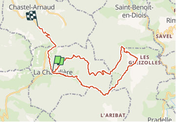

7.9 km | 11.2 km-effort

User


FREE GPS app for hiking
 SityTrail
IGN / Geographical institutes
SityTrail World
The world is yours!
Trail Walking of 20 km to be discovered at Auvergne-Rhône-Alpes, Drôme, La Chaudière. This trail is proposed by cousam.
Boucle au départ de la chaudière, en longeant la Coulance
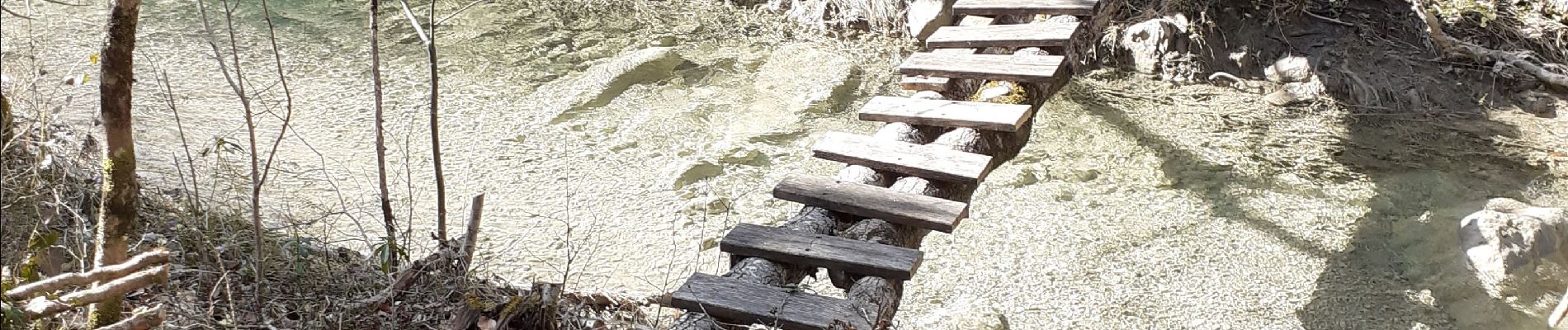
très Hard,surtout en février, car beaucoup d'eau.
Plusieurs rappels, pour contourner Les vasques .


Walking

Walking

Walking

Walking

Walking

Walking

Walking

Walking

Walking